Wildfire training on a virtual 100 km2
7 January 2021
Wildfire training on a virtual 100 km2
This November, XVR Simulation presented the Country Fire Authority (CFA) in Victoria, Australia, with two highly-anticipated, custom-built environments. Both environments span areas of 100 km2 and are fully compatible with the XVR On Scene Wildfire extension. They were developed as part of a research and development project with CFA. Once again, we partnered with MINDCONSOLE, who helped us achieve these extensive and rich environments which will massively contribute to wildfire training all around the world.
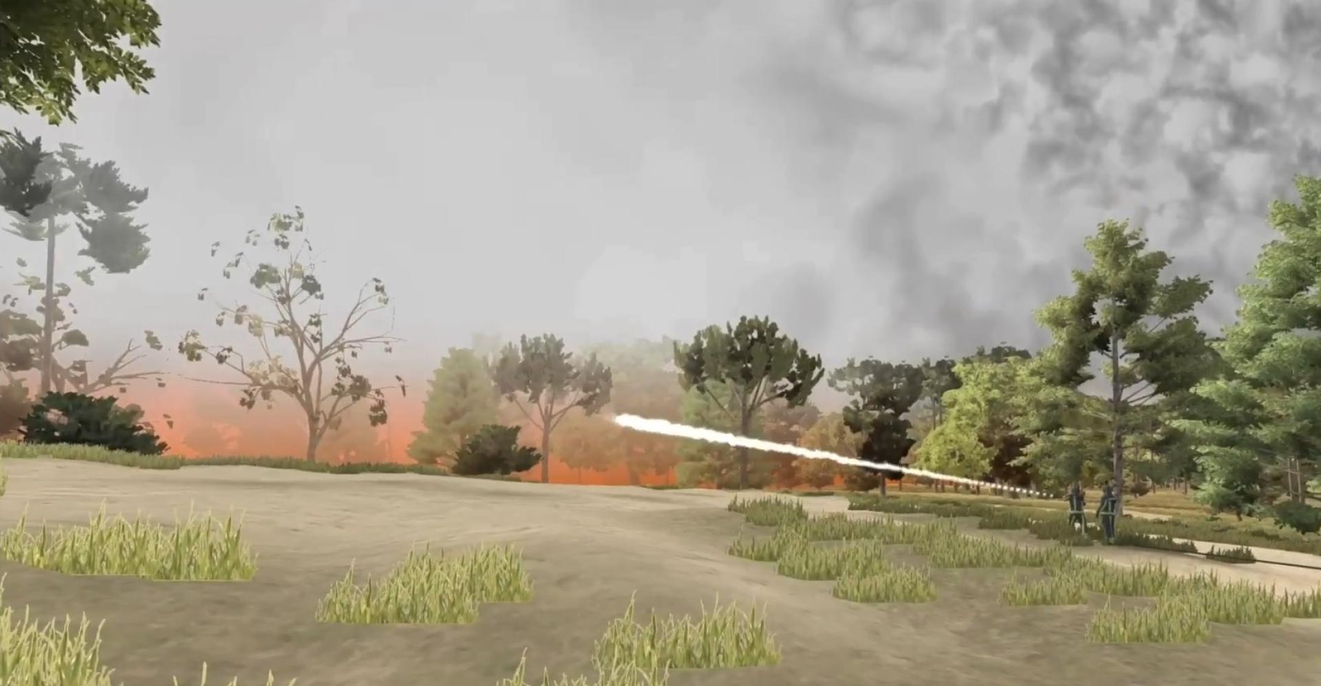
The two environments will be used by CFA for bushfire training for crew commanders, incident commanders, local community command, and state command centre – educating, training, and assessing everything from on-scene decision-making and resource allocation to community safety updates and evacuating entire towns. The environments cover two 10 x 10 km geo-specific areas outside Melbourne, the Plenty Gorge and Strathewen town and surrounding area, which are mainly hilly bushland and open grasslands interspersed with houses and other buildings. Participants will train communication skills, firefighting strategy, and fire propagation calculation, as wildfires spread rapidly and unpredictably. The Australian bushfire season is (approximately) from October to April in the southern part of the country, and any decision made on-scene and in command centres will have to factor in the fires’ possible progression hours, days, and weeks into the future. To effectively prepare the staff for the long season ahead, the environments needed to be as realistic as possible, and as wildfires spread over great distances, the maps also needed to be much larger than what was currently supported by XVR environments.
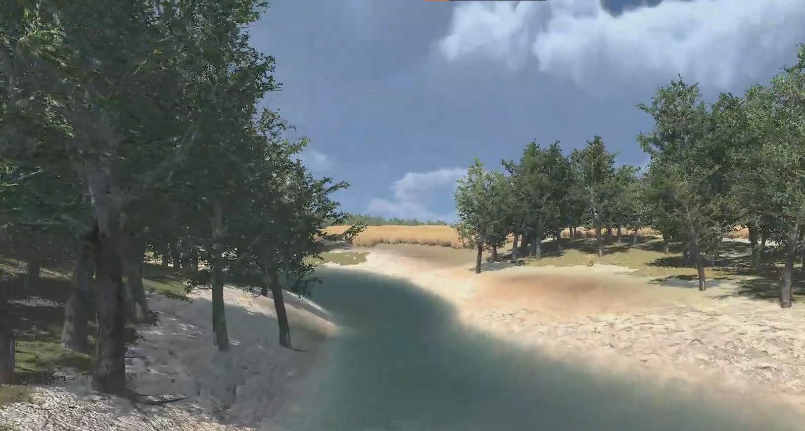
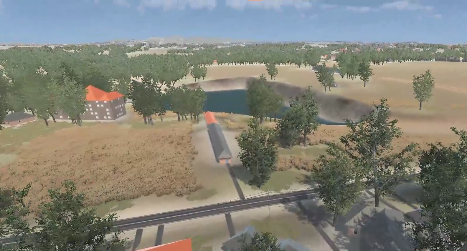
XVR Simulation has previously collaborated with MINDCONSOLE on custom environments where a high degree of realism and accuracy were required. These new environments, however, are remarkable for more reasons than their size. Where XVR Simulation normally builds all custom environments by hand, MINDCONSOLE used satellite footage, height maps, and governmental data (such as vegetation density and the placement of infrastructure, houses, and rivers) to build the geo-specific environments to match the real-life situation as realistically as possible. All roads and houses have the same locations and dimensions as in real life. Foliage sways in the wind. This is a huge amount of information that the software needs to process, but by using Houdini, a procedural generation software tool, the map processes all the individual elements automatically and quickly generates the environment. Where the previous XVR On Scene Wildfire-compatible environment would sometimes lag and be slow to load, especially as more objects were introduced, the new environments run at 60 fps and still operate smoothly when adding many objects.
Paul Cockerill, Computer Simulation Specialist at CFA, is enthusiastic about getting to work and including the new environments in their training efforts. “The new environments will help our members train better, with local knowledge, in an environment from their back yard,” he explains. “Members can also put into place plans that have been developed for incident response in those areas. They can see if those plans work, or whether they need adjusting.”
Watch the video below for an impression of the Strathewen and Plenty Gorge environments.
.jpg?resolution=20x19&quality=1&type=webp)

